


Venerque Doumerc fait

pidjam
User
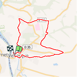

Length
9.1 km

Max alt
259 m

Uphill gradient
187 m
Km-Effort
11.6 km

Min alt
165 m

Downhill gradient
188 m
Boucle
Yes
Creation date :
2019-04-25 12:07:47.071
Updated on :
2019-04-25 15:51:32.286
2h13
Difficulty : Very easy

FREE GPS app for hiking
 SityTrail
IGN / Geographical institutes
SityTrail Plus
The world is yours!
About
Trail Walking of 9.1 km to be discovered at Occitania, Haute-Garonne, Venerque. This trail is proposed by pidjam.
Positioning
Country:
France
Region :
Occitania
Department/Province :
Haute-Garonne
Municipality :
Venerque
Location:
Unknown
Start:(Dec)
Start:(UTM)
373790 ; 4810133 (31T) N.
Comments