


9785060-beaumelesmessieurs-1

cherlieu
User
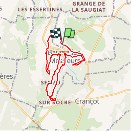

Length
15.4 km

Max alt
525 m

Uphill gradient
618 m
Km-Effort
24 km

Min alt
289 m

Downhill gradient
613 m
Boucle
Yes
Creation date :
2019-04-28 15:25:21.576
Updated on :
2019-05-01 07:33:00.504
4h54
Difficulty : Difficult

FREE GPS app for hiking
 SityTrail
IGN / Geographical institutes
SityTrail Plus
The world is yours!
About
Trail Walking of 15.4 km to be discovered at Bourgogne-Franche-Comté, Jura, Hauteroche. This trail is proposed by cherlieu.
Positioning
Country:
France
Region :
Bourgogne-Franche-Comté
Department/Province :
Jura
Municipality :
Hauteroche
Location:
Unknown
Start:(Dec)
Start:(UTM)
702174 ; 5176749 (31T) N.
Comments