


le fer à chaval - point 600 Alaric

mikaou.t
User
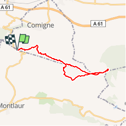

Length
14.1 km

Max alt
597 m

Uphill gradient
462 m
Km-Effort
20 km

Min alt
248 m

Downhill gradient
462 m
Boucle
Yes
Creation date :
2019-04-29 07:45:43.147
Updated on :
2019-04-29 13:13:46.669
4h10
Difficulty : Medium

FREE GPS app for hiking
 SityTrail
IGN / Geographical institutes
SityTrail Plus
The world is yours!
About
Trail Walking of 14.1 km to be discovered at Occitania, Aude, Val-de-Dagne. This trail is proposed by mikaou.t.
Positioning
Country:
France
Region :
Occitania
Department/Province :
Aude
Municipality :
Val-de-Dagne
Location:
Montlaur
Start:(Dec)
Start:(UTM)
464651 ; 4778435 (31T) N.
Comments