


PIBESTE PAR SEGUS

ehresmann
User
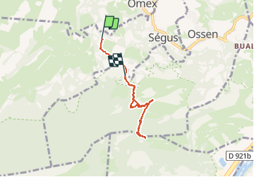

Length
6.3 km

Max alt
1340 m

Uphill gradient
631 m
Km-Effort
14.4 km

Min alt
726 m

Downhill gradient
530 m
Boucle
No
Creation date :
2014-12-10 00:00:00.0
Updated on :
2014-12-10 00:00:00.0
2h55
Difficulty : Medium

FREE GPS app for hiking
 SityTrail
IGN / Geographical institutes
SityTrail Plus
The world is yours!
About
Trail Walking of 6.3 km to be discovered at Occitania, Hautespyrenees, Ségus. This trail is proposed by ehresmann.
Description
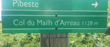
Le chemin est raide
Photos


Positioning
Country:
France
Region :
Occitania
Department/Province :
Hautespyrenees
Municipality :
Ségus
Location:
Unknown
Start:(Dec)
Start:(UTM)
736840 ; 4772621 (30T) N.
Comments