


La Doire Bauroux Seranon

ETMU5496
User

Length
18.2 km

Max alt
1630 m

Uphill gradient
836 m
Km-Effort
29 km

Min alt
1094 m

Downhill gradient
854 m
Boucle
Yes
Creation date :
2019-04-28 07:08:48.0
Updated on :
2024-04-02 14:46:14.966
5h18
Difficulty : Difficult

FREE GPS app for hiking
 SityTrail
IGN / Geographical institutes
SityTrail Plus
The world is yours!
About
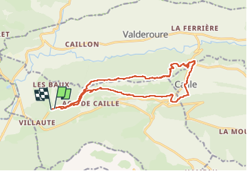
Trail Walking of 18.2 km to be discovered at Provence-Alpes-Côte d'Azur, Maritime Alps, Séranon. This trail is proposed by ETMU5496.
Description
Belle randonnée qui conduit sur les crêtes du Bauroux à 1644 m
retour par le joli village de Caille, Seranon et La Doire.
Positioning
Country:
France
Region :
Provence-Alpes-Côte d'Azur
Department/Province :
Maritime Alps
Municipality :
Séranon
Location:
Unknown
Start:(Dec)
Start:(UTM)
311970 ; 4848980 (32T) N.
Comments