RA 2019 Lot Tour de Saint Cirq

dfluzin
User
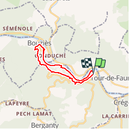

Length
10.8 km

Max alt
280 m

Uphill gradient
351 m
Km-Effort
15.5 km

Min alt
129 m

Downhill gradient
349 m
Boucle
Yes
Creation date :
2019-04-30 07:41:29.484
Updated on :
2019-04-30 13:08:00.368
3h45
Difficulty : Very easy

FREE GPS app for hiking
 SityTrail
IGN / Geographical institutes
SityTrail Plus
The world is yours!
About
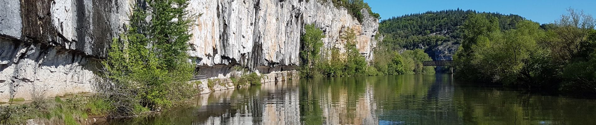
Trail Walking of 10.8 km to be discovered at Occitania, Lot, Saint-Cirq-Lapopie. This trail is proposed by dfluzin.
Photos


Positioning
Country:
France
Region :
Occitania
Department/Province :
Lot
Municipality :
Saint-Cirq-Lapopie
Location:
Unknown
Start:(Dec)
Start:(UTM)
395003 ; 4924759 (31T) N.
Comments