


z le plan Guinet 30-04-19

cb8310
User
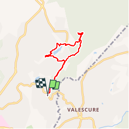

Length
6 km

Max alt
70 m

Uphill gradient
85 m
Km-Effort
7.1 km

Min alt
30 m

Downhill gradient
84 m
Boucle
Yes
Creation date :
2019-04-30 11:49:02.152
Updated on :
2019-05-04 06:00:05.315
2h06
Difficulty : Very easy

FREE GPS app for hiking
 SityTrail
IGN / Geographical institutes
SityTrail Plus
The world is yours!
About
Trail Walking of 6 km to be discovered at Provence-Alpes-Côte d'Azur, Var, Fréjus. This trail is proposed by cb8310.
Description
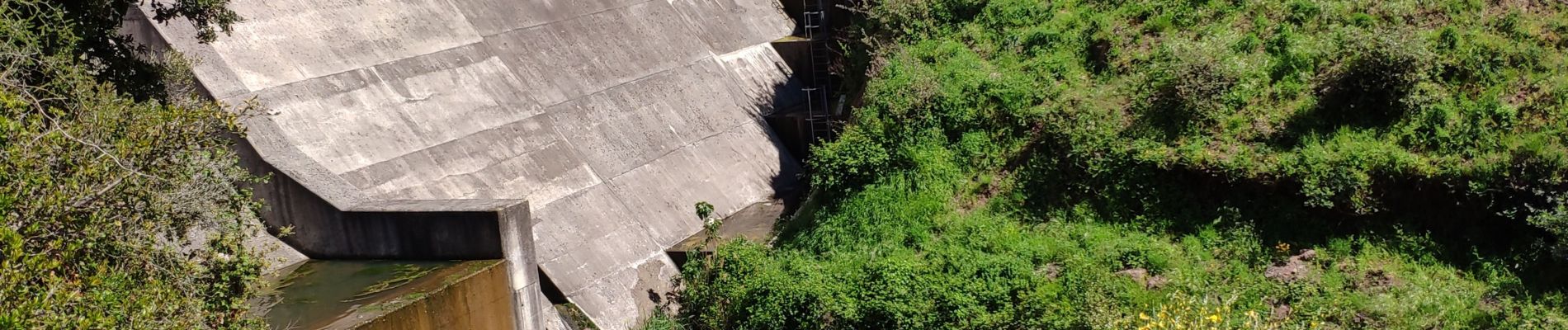
rando sans difficultés avec 2 petites montées au retour;parcours en partie ombragé;accès au lac St Esprit interdit du fait d'escargots exotiques !!!
Photos


Positioning
Country:
France
Region :
Provence-Alpes-Côte d'Azur
Department/Province :
Var
Municipality :
Fréjus
Location:
Unknown
Start:(Dec)
Start:(UTM)
319350 ; 4812768 (32T) N.
Comments