Les Versants du Ceans Les Begues

claude nier
User

Length
11.6 km

Max alt
1025 m

Uphill gradient
457 m
Km-Effort
17.7 km

Min alt
731 m

Downhill gradient
466 m
Boucle
Yes
Creation date :
2019-05-01 08:25:39.423
Updated on :
2019-05-01 14:19:06.426
3h55
Difficulty : Medium

FREE GPS app for hiking
 SityTrail
IGN / Geographical institutes
SityTrail Plus
The world is yours!
About
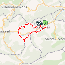
Trail Walking of 11.6 km to be discovered at Provence-Alpes-Côte d'Azur, Hautes-Alpes, Sainte-Colombe. This trail is proposed by claude nier.
Description
Reco avec Alinou
Super genial
Positioning
Country:
France
Region :
Provence-Alpes-Côte d'Azur
Department/Province :
Hautes-Alpes
Municipality :
Sainte-Colombe
Location:
Unknown
Start:(Dec)
Start:(UTM)
711209 ; 4908135 (31T) N.
Comments