


Châteauneuf d isere le chemin des carriers

meillon
User
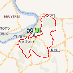

Length
9.4 km

Max alt
247 m

Uphill gradient
241 m
Km-Effort
12.6 km

Min alt
131 m

Downhill gradient
243 m
Boucle
Yes
Creation date :
2019-05-03 08:47:23.498
Updated on :
2019-05-03 14:35:33.707
4h25
Difficulty : Very easy

FREE GPS app for hiking
 SityTrail
IGN / Geographical institutes
SityTrail Plus
The world is yours!
About
Trail Walking of 9.4 km to be discovered at Auvergne-Rhône-Alpes, Drôme, Châteauneuf-sur-Isère. This trail is proposed by meillon.
Description
les habitata troglodytes
Positioning
Country:
France
Region :
Auvergne-Rhône-Alpes
Department/Province :
Drôme
Municipality :
Châteauneuf-sur-Isère
Location:
Unknown
Start:(Dec)
Start:(UTM)
653150 ; 4986544 (31T) N.
Comments
Je vais le refaire demain avec une amie. jirai jusqu'à Chateauneuf à vélo par la voie verte de l' Isere