


saint-chely saint martin

frank12
User

Length
102 km

Max alt
1394 m

Uphill gradient
2621 m
Km-Effort
138 km

Min alt
425 m

Downhill gradient
2994 m
Boucle
No
Creation date :
2019-05-05 10:01:35.252
Updated on :
2019-05-05 10:05:51.743
4h00
Difficulty : Easy

FREE GPS app for hiking
 SityTrail
IGN / Geographical institutes
SityTrail Plus
The world is yours!
About
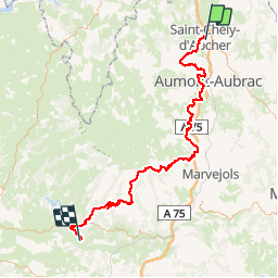
Trail Moto cross of 102 km to be discovered at Occitania, Lozère, Saint-Chély-d'Apcher. This trail is proposed by frank12.
Positioning
Country:
France
Region :
Occitania
Department/Province :
Lozère
Municipality :
Saint-Chély-d'Apcher
Location:
Unknown
Start:(Dec)
Start:(UTM)
521815 ; 4960552 (31T) N.
Comments
Bonjour, je viens de voir votre rando et j'aimerai savoir avec quel type de moto vous l'avez faite ? Pour ma par j'ai une Africa Twin 1000CRF. Pensez vous que cette rando et les autres que vous avez publiées sont faisables avec mon trail ? Merci de votre réponse