


9916530-Chennebrun 21.17

togolo28
User
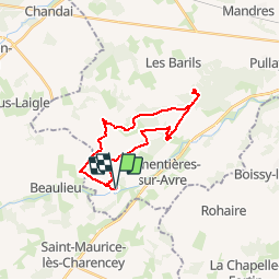

Length
21 km

Max alt
219 m

Uphill gradient
174 m
Km-Effort
24 km

Min alt
179 m

Downhill gradient
174 m
Boucle
Yes
Creation date :
2019-05-05 17:25:16.498
Updated on :
2019-12-01 14:21:25.254
--
Difficulty : Medium

FREE GPS app for hiking
 SityTrail
IGN / Geographical institutes
SityTrail Plus
The world is yours!
About
Trail Walking of 21 km to be discovered at Normandy, Eure, Chennebrun. This trail is proposed by togolo28.
Positioning
Country:
France
Region :
Normandy
Department/Province :
Eure
Municipality :
Chennebrun
Location:
Unknown
Start:(Dec)
Start:(UTM)
336780 ; 5394231 (31U) N.
Comments