


querybus

delaine
User
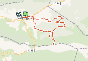

Length
10.9 km

Max alt
648 m

Uphill gradient
497 m
Km-Effort
17.6 km

Min alt
264 m

Downhill gradient
497 m
Boucle
Yes
Creation date :
2019-05-09 08:15:29.295
Updated on :
2019-05-09 13:43:26.149
5h25
Difficulty : Medium

FREE GPS app for hiking
 SityTrail
IGN / Geographical institutes
SityTrail Plus
The world is yours!
About
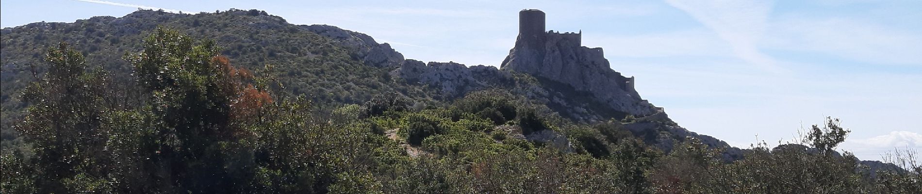
Trail Walking of 10.9 km to be discovered at Occitania, Aude, Cucugnan. This trail is proposed by delaine.
Photos


Positioning
Country:
France
Region :
Occitania
Department/Province :
Aude
Municipality :
Cucugnan
Location:
Unknown
Start:(Dec)
Start:(UTM)
467263 ; 4744205 (31T) N.
Comments