


burdinne

Steinier
User
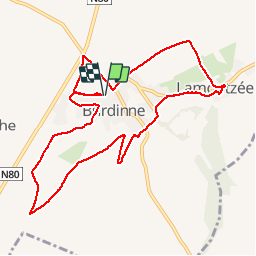

Length
9.8 km

Max alt
178 m

Uphill gradient
82 m
Km-Effort
10.9 km

Min alt
139 m

Downhill gradient
81 m
Boucle
Yes
Creation date :
2019-05-12 08:53:33.17
Updated on :
2019-05-12 10:39:52.835
1h45
Difficulty : Very easy

FREE GPS app for hiking
 SityTrail
IGN / Geographical institutes
SityTrail Plus
The world is yours!
About
Trail Walking of 9.8 km to be discovered at Wallonia, Liège, Burdinne. This trail is proposed by Steinier.
Positioning
Country:
Belgium
Region :
Wallonia
Department/Province :
Liège
Municipality :
Burdinne
Location:
Burdinne
Start:(Dec)
Start:(UTM)
646616 ; 5605489 (31U) N.
Comments