


lamalou, col de layrac, st gervais, col des 13 vents

francislassauce
User
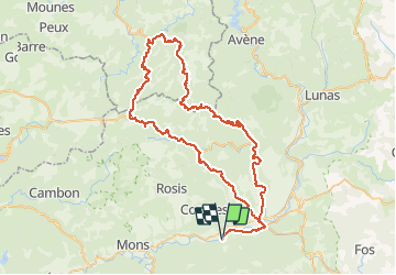

Length
85 km

Max alt
915 m

Uphill gradient
1806 m
Km-Effort
109 km

Min alt
165 m

Downhill gradient
1805 m
Boucle
Yes
Creation date :
2014-12-10 00:00:00.0
Updated on :
2014-12-10 00:00:00.0
6h15
Difficulty : Difficult

FREE GPS app for hiking
 SityTrail
IGN / Geographical institutes
SityTrail Plus
The world is yours!
About
Trail Cycle of 85 km to be discovered at Occitania, Hérault, Les Aires. This trail is proposed by francislassauce.
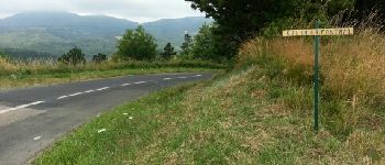
Photos


Positioning
Country:
France
Region :
Occitania
Department/Province :
Hérault
Municipality :
Les Aires
Location:
Unknown
Start:(Dec)
Start:(UTM)
505609 ; 4824838 (31T) N.
Comments