


belle étoile sud

oliviergau
User
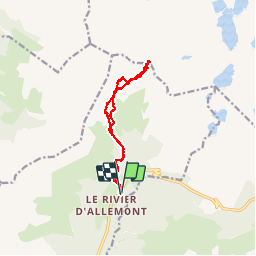

Length
12.4 km

Max alt
2699 m

Uphill gradient
1435 m
Km-Effort
32 km

Min alt
1272 m

Downhill gradient
1436 m
Boucle
Yes
Creation date :
2019-05-12 20:02:06.499
Updated on :
2019-05-12 20:02:06.499
--
Difficulty : Unknown

FREE GPS app for hiking
 SityTrail
IGN / Geographical institutes
SityTrail Plus
The world is yours!
About
Trail Touring skiing of 12.4 km to be discovered at Auvergne-Rhône-Alpes, Isère, Allemond. This trail is proposed by oliviergau.
Positioning
Country:
France
Region :
Auvergne-Rhône-Alpes
Department/Province :
Isère
Municipality :
Allemond
Location:
Unknown
Start:(Dec)
Start:(UTM)
267840 ; 5009973 (32T) N.
Comments