


GALBERT 300

oliviergau
User
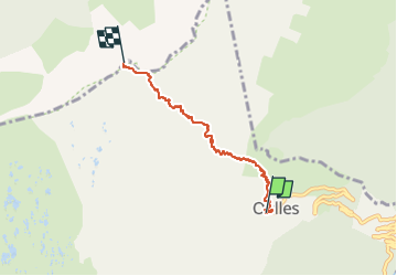

Length
4.3 km

Max alt
2544 m

Uphill gradient
1129 m
Km-Effort
15.6 km

Min alt
1409 m

Downhill gradient
2 m
Boucle
No
Creation date :
2019-05-12 20:10:14.898
Updated on :
2019-05-12 20:10:14.898
--
Difficulty : Unknown

FREE GPS app for hiking
 SityTrail
IGN / Geographical institutes
SityTrail Plus
The world is yours!
About
Trail Touring skiing of 4.3 km to be discovered at Auvergne-Rhône-Alpes, Isère, Oulles. This trail is proposed by oliviergau.
Positioning
Country:
France
Region :
Auvergne-Rhône-Alpes
Department/Province :
Isère
Municipality :
Oulles
Location:
Unknown
Start:(Dec)
Start:(UTM)
734634 ; 4995438 (31T) N.
Comments