


GRDE CHARVIA

oliviergau
User

Length
4.6 km

Max alt
2627 m

Uphill gradient
740 m
Km-Effort
12 km

Min alt
1883 m

Downhill gradient
5 m
Boucle
No
Creation date :
2019-05-12 20:10:37.696
Updated on :
2019-05-12 20:10:37.696
--
Difficulty : Unknown

FREE GPS app for hiking
 SityTrail
IGN / Geographical institutes
SityTrail Plus
The world is yours!
About
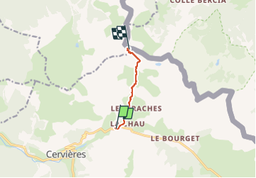
Trail Touring skiing of 4.6 km to be discovered at Provence-Alpes-Côte d'Azur, Hautes-Alpes, Cervières. This trail is proposed by oliviergau.
Positioning
Country:
France
Region :
Provence-Alpes-Côte d'Azur
Department/Province :
Hautes-Alpes
Municipality :
Cervières
Location:
Unknown
Start:(Dec)
Start:(UTM)
321938 ; 4971911 (32T) N.
Comments