


St Aubin des Chateaux

chasle
User

Length
23 km

Max alt
86 m

Uphill gradient
243 m
Km-Effort
26 km

Min alt
31 m

Downhill gradient
242 m
Boucle
Yes
Creation date :
2019-05-13 17:50:32.046
Updated on :
2019-05-13 17:51:44.174
5h44
Difficulty : Easy

FREE GPS app for hiking
 SityTrail
IGN / Geographical institutes
SityTrail Plus
The world is yours!
About
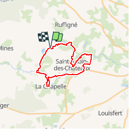
Trail Walking of 23 km to be discovered at Pays de la Loire, Loire-Atlantique, Saint-Aubin-des-Châteaux. This trail is proposed by chasle.
Positioning
Country:
France
Region :
Pays de la Loire
Department/Province :
Loire-Atlantique
Municipality :
Saint-Aubin-des-Châteaux
Location:
Unknown
Start:(Dec)
Start:(UTM)
611389 ; 5287861 (30T) N.
Comments