


J6 G3 Le Cap Canaille

LouisROGER
User GUIDE

Length
10.8 km

Max alt
380 m

Uphill gradient
470 m
Km-Effort
17.6 km

Min alt
3 m

Downhill gradient
610 m
Boucle
No
Creation date :
2019-05-14 08:34:04.241
Updated on :
2019-05-14 08:34:30.39
3h31
Difficulty : Difficult

FREE GPS app for hiking
 SityTrail
IGN / Geographical institutes
SityTrail Plus
The world is yours!
About
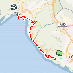
Trail Walking of 10.8 km to be discovered at Provence-Alpes-Côte d'Azur, Bouches-du-Rhône, La Ciotat. This trail is proposed by LouisROGER.
Positioning
Country:
France
Region :
Provence-Alpes-Côte d'Azur
Department/Province :
Bouches-du-Rhône
Municipality :
La Ciotat
Location:
Unknown
Start:(Dec)
Start:(UTM)
710003 ; 4783334 (31T) N.
Comments