Trail Walking Groffliers - 9kRandoGroffliers - Photo
 Robert62
Robert62

User

© OpenStreetMap contributors
Length
Length
9.3 km
Max alt
Max alt
22 m
Uphill gradient
Uphill gradient
47 m
Km-Effort
Km-Effort  
9.9 km
Min alt
Min alt
1 m
Downhill gradient
Downhill gradient
47 m
Boucle
Boucle
Yes
Creation date :
2019-05-14 15:10:22.987
Updated on :
2019-08-25 13:51:21.522

(0 Reviews)

Walking
Walking
2h13
Difficulty : Medium

Scan this QR Code to open this trail in the SityTrail application

FREE GPS app for hiking

Logo SityTrail SityTrail

IGN / Geographical institutes

Download SityTrail from the App Store Download SityTrail from Google Play

Logo SityTrail SityTrail Plus

The world is yours!

Download SityTrail from the App Store Download SityTrail from Google Play Download SityTrail on Huawei AppGallery

About

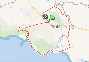
Trail Walking of 9.3 km to be discovered at Hauts-de-France, Pas-de-Calais, Groffliers. This trail is proposed by Robert62.

Description

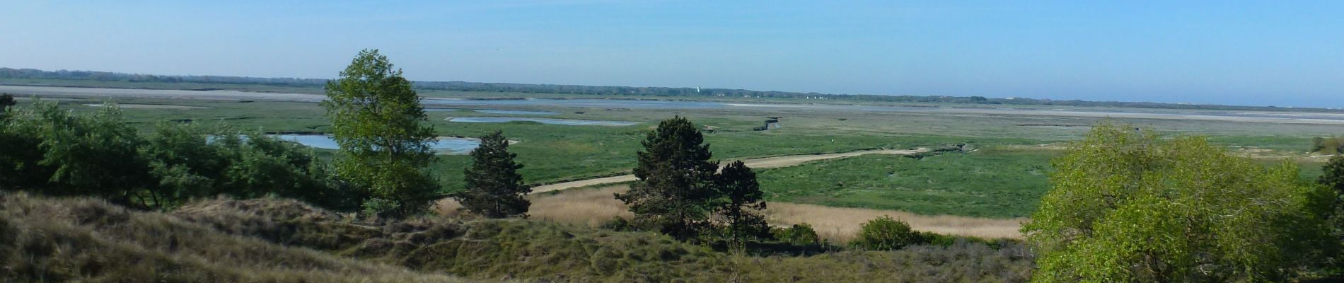
Randonnée au départ de la mairie  de Groffliers via la Basse rue vers" la Solitude"prendre le sentier qui monte à gauche vers le nouveau point de vue (mai 2019) de  la baie d'Authie, rejoindre le le GR 120 côtier jusque La Madelon,rejoindre et traverser la D 940 à la sortie de Groffliers, prendre juste en face le chemin caillouté jusqu'à D 142 E, tourner à gauche vers Groffliers pour rejoindre le point de départ

Elevation profile

Photos

Positioning

Country:
France
Region :
Hauts-de-France
Department/Province :
Pas-de-Calais
Municipality :
Groffliers
Location:
Unknown
Start:(UTM)
401616 ; 5582279 (31U) N.


Close
My subscriptions