


Le Rayol - Le Canadel

soca
User

Length
10.3 km

Max alt
257 m

Uphill gradient
406 m
Km-Effort
15.7 km

Min alt
23 m

Downhill gradient
406 m
Boucle
Yes
Creation date :
2019-05-16 03:32:29.703
Updated on :
2019-05-16 03:34:34.86
3h16
Difficulty : Medium

FREE GPS app for hiking
 SityTrail
IGN / Geographical institutes
SityTrail Plus
The world is yours!
About
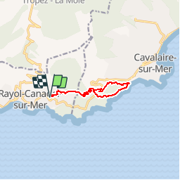
Trail Walking of 10.3 km to be discovered at Provence-Alpes-Côte d'Azur, Var, Rayol-Canadel-sur-Mer. This trail is proposed by soca.
Positioning
Country:
France
Region :
Provence-Alpes-Côte d'Azur
Department/Province :
Var
Municipality :
Rayol-Canadel-sur-Mer
Location:
Unknown
Start:(Dec)
Start:(UTM)
295169 ; 4781649 (32T) N.
Comments