


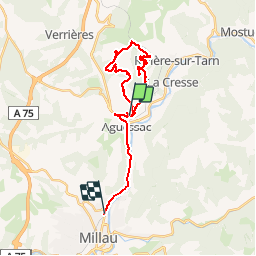
Compeyre 3 châteaux Luzergue

grageot
User

Length
25 km

Max alt
858 m

Uphill gradient
692 m
Km-Effort
34 km

Min alt
365 m

Downhill gradient
785 m
Boucle
No
Creation date :
2019-05-16 06:55:39.099
Updated on :
2019-05-16 13:16:25.234
5h09
Difficulty : Very easy

FREE GPS app for hiking
 SityTrail
IGN / Geographical institutes
SityTrail Plus
The world is yours!
About
Trail Walking of 25 km to be discovered at Occitania, Aveyron, Compeyre. This trail is proposed by grageot.
Positioning
Country:
France
Region :
Occitania
Department/Province :
Aveyron
Municipality :
Compeyre
Location:
Unknown
Start:(Dec)
Start:(UTM)
507931 ; 4889796 (31T) N.
Comments