


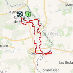
16.05.2019 - ST Malo de BEIGNON à GUER

babeth35
User

Length
31 km

Max alt
133 m

Uphill gradient
473 m
Km-Effort
37 km

Min alt
27 m

Downhill gradient
470 m
Boucle
Yes
Creation date :
2019-05-16 05:45:36.0
Updated on :
2019-05-18 16:09:40.287
7h37
Difficulty : Difficult

FREE GPS app for hiking
 SityTrail
IGN / Geographical institutes
SityTrail Plus
The world is yours!
About
Trail Walking of 31 km to be discovered at Brittany, Morbihan, Saint-Malo-de-Beignon. This trail is proposed by babeth35.
Photos


Positioning
Country:
France
Region :
Brittany
Department/Province :
Morbihan
Municipality :
Saint-Malo-de-Beignon
Location:
Unknown
Start:(Dec)
Start:(UTM)
563725 ; 5311815 (30T) N.
Comments