Trail Walking Vollore-Montagne - Vollore_Pierre_Pamole - Photo
 jagarnier
jagarnier

User GUIDE

© OpenStreetMap contributors
Length
Length
16.5 km
Max alt
Max alt
1191 m
Uphill gradient
Uphill gradient
519 m
Km-Effort
Km-Effort  
23 km
Min alt
Min alt
841 m
Downhill gradient
Downhill gradient
519 m
Boucle
Boucle
Yes
Creation date :
2019-05-17 07:39:31.166
Updated on :
2022-07-03 05:37:24.315

(0 Reviews)

Walking
Walking
5h15
Difficulty : Medium

Scan this QR Code to open this trail in the SityTrail application

FREE GPS app for hiking

Logo SityTrail SityTrail

IGN / Geographical institutes

Download SityTrail from the App Store Download SityTrail from Google Play

Logo SityTrail SityTrail World

The world is yours!

Download SityTrail from the App Store Download SityTrail from Google Play Download SityTrail on Huawei AppGallery

About

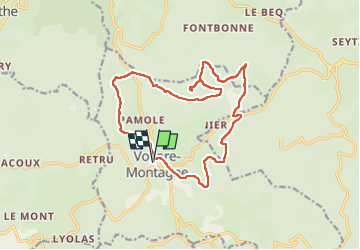
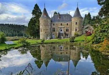
Trail Walking of 16.5 km to be discovered at Auvergne-Rhône-Alpes, Puy-de-Dôme, Vollore-Montagne. This trail is proposed by jagarnier.

Description

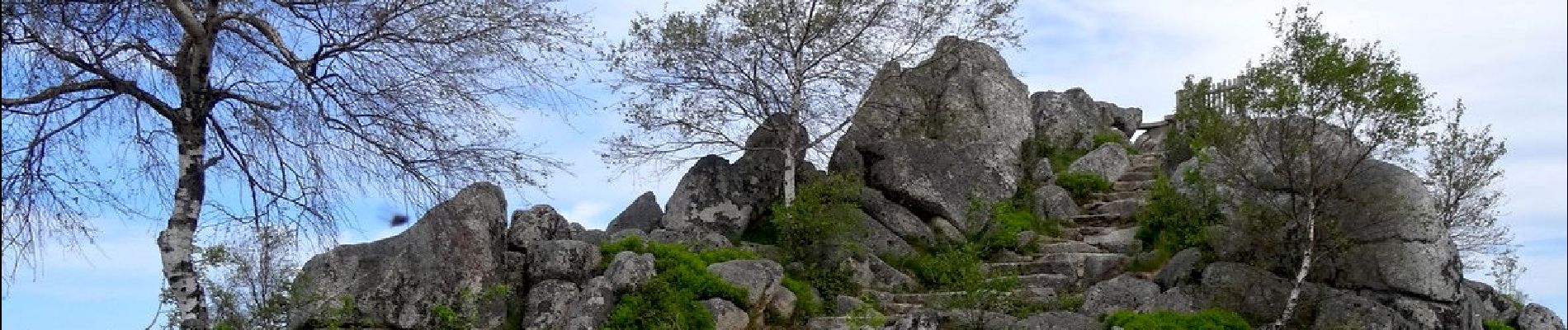
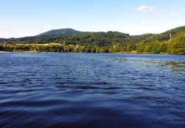
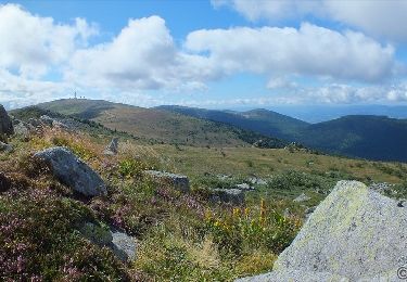
Le site de Pierre Pamole est situé à l'extrémité nord des Monts du Forez.
Son socle est constitué de roches magmatiques et métamorphiques. Le sommet est coiffé de plusieurs chaos granitiques.
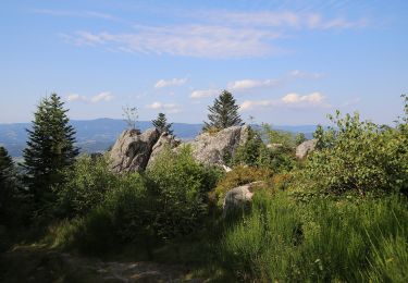
L'édification de la chaîne s'est réalisée à l'ère primaire. Au tertiaire, le cycle alpin a créé le relief actuel avec des monts et des vallées.
Cet épisode s'est terminé par une phase volcanique, puis les glaciations du quaternaire ont érodé le paysage pour lui donner sa forme actuelle.

Elevation profile

Photos

Positioning

Country:
France
Region :
Auvergne-Rhône-Alpes
Department/Province :
Puy-de-Dôme
Municipality :
Vollore-Montagne
Location:
Unknown
Start:(UTM)
552363 ; 5070430 (31T) N.

Trails nearby

Trail On foot Vollore-Montagne - Pierre Pamole - Photo
On foot
PRO

On foot

Medium
Vollore-Montagne, Auvergne-Rhône-Alpes, Puy-de-Dôme, France
15.5 km | 22 km-effort
4h 57min
Yes
Trail On foot Vollore-Ville - Le Grun de Chignore - Photo
On foot
PRO

On foot

Medium
Vollore-Ville, Auvergne-Rhône-Alpes, Puy-de-Dôme, France
15.1 km | 24 km-effort
5h 27min
No
Trail Walking Viscomtat - La Virée des Rocs Nº2/Rocher de Pierre Beille - Photo
Walking
boulinevelyne

Walking

Difficult
Viscomtat, Auvergne-Rhône-Alpes, Puy-de-Dôme, France
16.1 km | 23 km-effort
4h 45min
Yes
Trail Walking Noirétable - De Notre Dame L’héritage a Chabreloche  - Photo
Walking
NANE51

Walking

Medium
Noirétable, Auvergne-Rhône-Alpes, Loire, France
18.6 km | 26 km-effort
6h 6min
No
Trail Walking Sainte-Agathe - Ste_Agathe_Peage - Photo
Walking
GUIDE
jagarnier

Walking

Medium
Sainte-Agathe, Auvergne-Rhône-Alpes, Puy-de-Dôme, France
11.1 km | 16.4 km-effort
3h 15min
Yes
Trail Walking Sainte-Agathe - Saint agate 3ieme jour - Photo
Walking
jpdroux

Walking

Difficult
Sainte-Agathe, Auvergne-Rhône-Alpes, Puy-de-Dôme, France
11.6 km | 16.1 km-effort
4h 45min
Yes
Trail On foot Vollore-Montagne - Le Lit de la Vierge - Photo
On foot
PRO

On foot

Easy
Vollore-Montagne, Auvergne-Rhône-Alpes, Puy-de-Dôme, France
10.5 km | 15.2 km-effort
3h 27min
No
Trail Walking Aubusson-d'Auvergne - Aubusson_Fontcuberte - Photo
Walking
GUIDE
jagarnier

Walking

Medium
Aubusson-d'Auvergne, Auvergne-Rhône-Alpes, Puy-de-Dôme, France
12.1 km | 17 km-effort
3h 5min
Yes
Trail Walking Vollore-Montagne - Vollore_Lit_Vierge - Photo
Walking
GUIDE
jagarnier

Walking

Medium
Vollore-Montagne, Auvergne-Rhône-Alpes, Puy-de-Dôme, France
10.6 km | 15.3 km-effort
2h 57min
Yes


Close
My subscriptions