


9916519-AUBRAC 2019 - 5 - RaG

mic-13
User
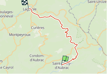

Length
23 km

Max alt
1336 m

Uphill gradient
857 m
Km-Effort
33 km

Min alt
816 m

Downhill gradient
678 m
Boucle
No
Creation date :
2019-05-18 08:02:33.092
Updated on :
2019-05-18 08:03:10.516
7h05
Difficulty : Medium

FREE GPS app for hiking
 SityTrail
IGN / Geographical institutes
SityTrail Plus
The world is yours!
About
Trail Walking of 23 km to be discovered at Occitania, Aveyron, Saint-Chély-d'Aubrac. This trail is proposed by mic-13.


Positioning
Country:
France
Region :
Occitania
Department/Province :
Aveyron
Municipality :
Saint-Chély-d'Aubrac
Location:
Unknown
Start:(Dec)
Start:(UTM)
493690 ; 4937493 (31T) N.
Comments