


Saretto Mont Soubeyran

oliviergau
User
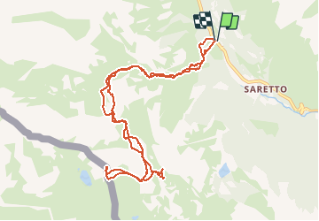

Length
11.3 km

Max alt
2675 m

Uphill gradient
1138 m
Km-Effort
26 km

Min alt
1538 m

Downhill gradient
1140 m
Boucle
Yes
Creation date :
2019-05-18 17:19:57.472
Updated on :
2019-05-18 17:19:57.472

FREE GPS app for hiking
 SityTrail
IGN / Geographical institutes
SityTrail Plus
The world is yours!
About
Trail of 11.3 km to be discovered at Piemont, Cuneo, Acceglio. This trail is proposed by oliviergau.
Positioning
Country:
Italy
Region :
Piemont
Department/Province :
Cuneo
Municipality :
Acceglio
Location:
Unknown
Start:(Dec)
Start:(UTM)
335213 ; 4927860 (32T) N.
Comments