


Sommet des Anges

oliviergau
User

Length
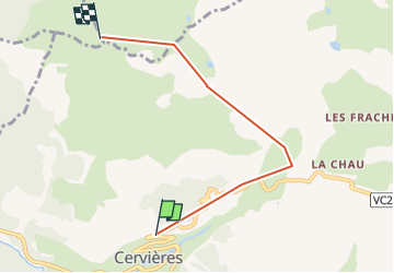
4.9 km

Max alt
2449 m

Uphill gradient
806 m
Km-Effort
13.2 km

Min alt
1694 m

Downhill gradient
58 m
Boucle
No
Creation date :
2019-05-18 17:19:59.948
Updated on :
2019-05-18 17:19:59.948

FREE GPS app for hiking
 SityTrail
IGN / Geographical institutes
SityTrail Plus
The world is yours!
About
Trail of 4.9 km to be discovered at Provence-Alpes-Côte d'Azur, Hautes-Alpes, Cervières. This trail is proposed by oliviergau.
Positioning
Country:
France
Region :
Provence-Alpes-Côte d'Azur
Department/Province :
Hautes-Alpes
Municipality :
Cervières
Location:
Unknown
Start:(Dec)
Start:(UTM)
320098 ; 4971276 (32T) N.
Comments