


TETE DE PLATE

oliviergau
User
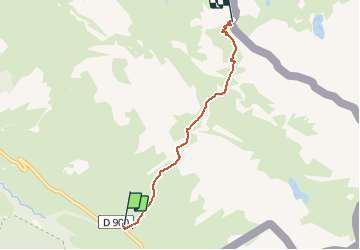

Length
4.2 km

Max alt
2710 m

Uphill gradient
750 m
Km-Effort
11.7 km

Min alt
1950 m

Downhill gradient
0 m
Boucle
No
Creation date :
2019-05-18 17:20:28.362
Updated on :
2019-05-18 17:20:28.362

FREE GPS app for hiking
 SityTrail
IGN / Geographical institutes
SityTrail Plus
The world is yours!
About
Trail of 4.2 km to be discovered at Provence-Alpes-Côte d'Azur, Alpes-de-Haute-Provence, Val-d'Oronaye. This trail is proposed by oliviergau.
Positioning
Country:
France
Region :
Provence-Alpes-Côte d'Azur
Department/Province :
Alpes-de-Haute-Provence
Municipality :
Val-d'Oronaye
Location:
Larche
Start:(Dec)
Start:(UTM)
332255 ; 4921503 (32T) N.
Comments