


Tracé_Scalletta

oliviergau
User
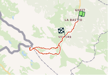

Length
13.4 km

Max alt
2763 m

Uphill gradient
1278 m
Km-Effort
30 km

Min alt
1480 m

Downhill gradient
1058 m
Boucle
No
Creation date :
2019-05-18 17:20:46.682
Updated on :
2019-05-18 17:20:46.682

FREE GPS app for hiking
 SityTrail
IGN / Geographical institutes
SityTrail Plus
The world is yours!
About
Trail of 13.4 km to be discovered at Piemont, Cuneo, Acceglio. This trail is proposed by oliviergau.
Positioning
Country:
Italy
Region :
Piemont
Department/Province :
Cuneo
Municipality :
Acceglio
Location:
Unknown
Start:(Dec)
Start:(UTM)
340896 ; 4923736 (32T) N.
Comments