


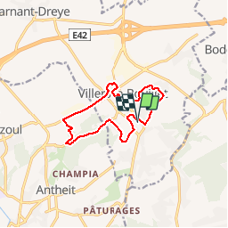
Villiers le bouillet

Steinier
User

Length
10.3 km

Max alt
202 m

Uphill gradient
138 m
Km-Effort
12.1 km

Min alt
132 m

Downhill gradient
137 m
Boucle
Yes
Creation date :
2019-05-19 08:51:41.985
Updated on :
2019-05-19 10:49:07.216
1h56
Difficulty : Very easy

FREE GPS app for hiking
 SityTrail
IGN / Geographical institutes
SityTrail Plus
The world is yours!
About
Trail Walking of 10.3 km to be discovered at Wallonia, Liège, Villers-le-Bouillet. This trail is proposed by Steinier.
Positioning
Country:
Belgium
Region :
Wallonia
Department/Province :
Liège
Municipality :
Villers-le-Bouillet
Location:
Villers-le-Bouillet
Start:(Dec)
Start:(UTM)
660584 ; 5604237 (31U) N.
Comments