


chateauvallon_le Croupatier

bernir
User
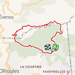

Length
8.5 km

Max alt
489 m

Uphill gradient
374 m
Km-Effort
13.4 km

Min alt
130 m

Downhill gradient
372 m
Boucle
Yes
Creation date :
2019-05-19 11:59:44.852
Updated on :
2019-05-19 17:18:51.688
3h51
Difficulty : Medium

FREE GPS app for hiking
 SityTrail
IGN / Geographical institutes
SityTrail Plus
The world is yours!
About
Trail Walking of 8.5 km to be discovered at Provence-Alpes-Côte d'Azur, Var, Ollioules. This trail is proposed by bernir.
Positioning
Country:
France
Region :
Provence-Alpes-Côte d'Azur
Department/Province :
Var
Municipality :
Ollioules
Location:
Unknown
Start:(Dec)
Start:(UTM)
733651 ; 4781149 (31T) N.
Comments