


RS-Col Lachard

raymondfn
User

Length
4.5 km

Max alt
724 m

Uphill gradient
69 m
Km-Effort
5.5 km

Min alt
677 m

Downhill gradient
69 m
Boucle
Yes
Creation date :
2019-05-20 09:47:17.928
Updated on :
2019-05-20 09:51:59.227
34m
Difficulty : Easy

FREE GPS app for hiking
 SityTrail
IGN / Geographical institutes
SityTrail Plus
The world is yours!
About
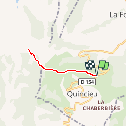
Trail Walking of 4.5 km to be discovered at Auvergne-Rhône-Alpes, Isère, Quincieu. This trail is proposed by raymondfn.
Description
Aller retour sur une petite route, en crête.
Beaux panoramas.
Nombreuses fleurs en mai/juin.
Positioning
Country:
France
Region :
Auvergne-Rhône-Alpes
Department/Province :
Isère
Municipality :
Quincieu
Location:
Unknown
Start:(Dec)
Start:(UTM)
687528 ; 5016794 (31T) N.
Comments