


Beaucens Course à pied tout terrain

julien6509
User
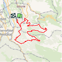

Length
21 km

Max alt
1734 m

Uphill gradient
1596 m
Km-Effort
43 km

Min alt
522 m

Downhill gradient
1608 m
Boucle
Yes
Creation date :
2019-05-24 12:59:14.884
Updated on :
2019-05-24 13:05:40.499

FREE GPS app for hiking
 SityTrail
IGN / Geographical institutes
SityTrail Plus
The world is yours!
About
Trail of 21 km to be discovered at Occitania, Hautespyrenees, Beaucens. This trail is proposed by julien6509.
Positioning
Country:
France
Region :
Occitania
Department/Province :
Hautespyrenees
Municipality :
Beaucens
Location:
Unknown
Start:(Dec)
Start:(UTM)
739850 ; 4761773 (30T) N.
Comments