Tour de l’île : St Laurent-sur-Saône

robertdurand
User

Length
6.7 km

Max alt
186 m

Uphill gradient
51 m
Km-Effort
7.3 km

Min alt
162 m

Downhill gradient
51 m
Boucle
Yes
Creation date :
2019-05-22 13:13:36.0
Updated on :
2019-05-25 12:15:17.489
2h18
Difficulty : Easy

FREE GPS app for hiking
 SityTrail
IGN / Geographical institutes
SityTrail Plus
The world is yours!
About
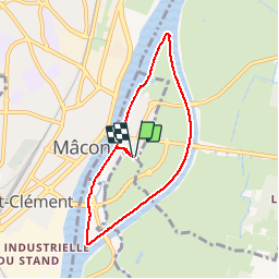
Trail Walking of 6.7 km to be discovered at Auvergne-Rhône-Alpes, Ain, Saint-Laurent-sur-Saône. This trail is proposed by robertdurand.
Description
Ballade entre canal de dérivation et la Saône.
Positioning
Country:
France
Region :
Auvergne-Rhône-Alpes
Department/Province :
Ain
Municipality :
Saint-Laurent-sur-Saône
Location:
Unknown
Start:(Dec)
Start:(UTM)
641757 ; 5129327 (31T) N.
Comments