


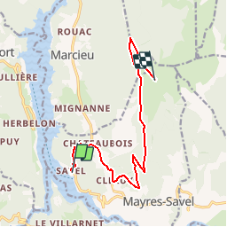
LeSenepy par Savel Plage

claude nier
User

Length
11.5 km

Max alt
1765 m

Uphill gradient
1363 m
Km-Effort
25 km

Min alt
500 m

Downhill gradient
103 m
Boucle
No
Creation date :
2019-05-26 15:10:22.871
Updated on :
2019-05-26 15:12:07.005
5h42
Difficulty : Very difficult

FREE GPS app for hiking
 SityTrail
IGN / Geographical institutes
SityTrail Plus
The world is yours!
About
Trail Walking of 11.5 km to be discovered at Auvergne-Rhône-Alpes, Isère, Mayres-Savel. This trail is proposed by claude nier.
Description
Depart chateau de Savel
grosse rando...a faire
Positioning
Country:
France
Region :
Auvergne-Rhône-Alpes
Department/Province :
Isère
Municipality :
Mayres-Savel
Location:
Unknown
Start:(Dec)
Start:(UTM)
712357 ; 4973386 (31T) N.
Comments