Trail Walking Boudes - Boudes_Vallee_Saints - Photo
 jagarnier
jagarnier

User GUIDE

© OpenStreetMap contributors
Length
Length
10.9 km
Max alt
Max alt
628 m
Uphill gradient
Uphill gradient
315 m
Km-Effort
Km-Effort  
15.1 km
Min alt
Min alt
458 m
Downhill gradient
Downhill gradient
315 m
Boucle
Boucle
Yes
Creation date :
2019-05-27 09:35:47.59
Updated on :
2023-11-15 16:27:18.369

(1 Reviews)

Walking
Walking
3h15
Difficulty : Medium

Scan this QR Code to open this trail in the SityTrail application

FREE GPS app for hiking

Logo SityTrail SityTrail

IGN / Geographical institutes

Download SityTrail from the App Store Download SityTrail from Google Play

Logo SityTrail SityTrail World

The world is yours!

Download SityTrail from the App Store Download SityTrail from Google Play Download SityTrail on Huawei AppGallery

About

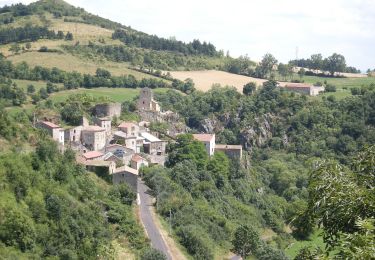
Trail Walking of 10.9 km to be discovered at Auvergne-Rhône-Alpes, Puy-de-Dôme, Boudes. This trail is proposed by jagarnier.

Description

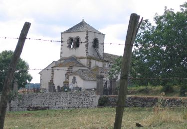
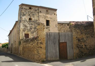
Une promenade dans le village vous permettra de voir de beaux pigeonniers.
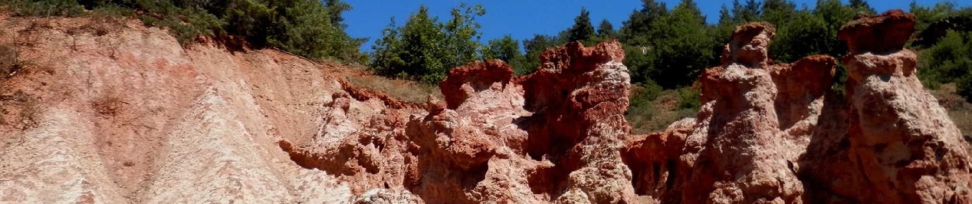
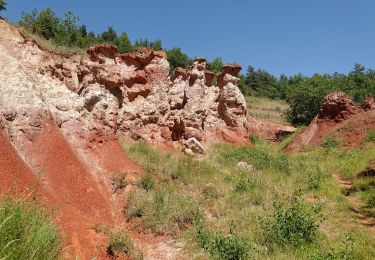
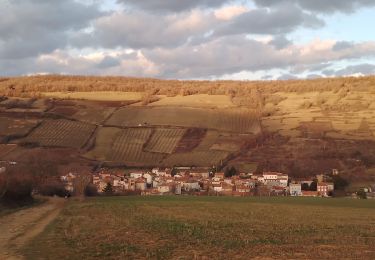
La rando dans la vallée des saints permet de découvrir ce petit "Colorado" où se dressent des pyramides de teinte rouge et ocre hautes de 10 à 30 m. sculptées par l'érosion. Ces étranges silhouettes évoquent de gigantesques statues, ce qui a valu son nom à la vallée.

Elevation profile

Photos

Positioning

Country:
France
Region :
Auvergne-Rhône-Alpes
Department/Province :
Puy-de-Dôme
Municipality :
Boudes
Location:
Unknown
Start:(UTM)
514628 ; 5033750 (31T) N.

Comments

Please log in to post a review or rate the element


Trails nearby

Trail Walking Vichel - Saint Gervazy - Photo
Walking
tracegps

Walking

Difficult
(1)
Vichel, Auvergne-Rhône-Alpes, Puy-de-Dôme, France
10.3 km | 14.8 km-effort
3h 0min
Yes
Trail On foot Boudes - Villeneuve, Boudes, Chalus - Photo
On foot
PRO

On foot

Easy
Boudes, Auvergne-Rhône-Alpes, Puy-de-Dôme, France
9 km | 13.3 km-effort
3h 0min
Yes
Trail On foot Madriat - Bard et Letz - Photo
On foot
PRO

On foot

Easy
Madriat, Auvergne-Rhône-Alpes, Puy-de-Dôme, France
9.9 km | 13.3 km-effort
3h 1min
Yes
Trail On foot Boudes - La Vallee des Saints - Photo
On foot
PRO

On foot

Easy
(1)
Boudes, Auvergne-Rhône-Alpes, Puy-de-Dôme, France
8.1 km | 11.1 km-effort
2h 31min
Yes
Trail On foot Mareugheol - La Chaux et le Bois de Jaby - Photo
On foot
PRO

On foot

Easy
Mareugheol, Auvergne-Rhône-Alpes, Puy-de-Dôme, France
10.1 km | 13.7 km-effort
3h 7min
Yes
Trail On foot Villeneuve - Vodable et Colamine - Photo
On foot
PRO

On foot

Easy
Villeneuve, Auvergne-Rhône-Alpes, Puy-de-Dôme, France
12 km | 16.6 km-effort
3h 45min
No
Trail On foot Gignat - Les Coteaux et la Chaux - Photo
On foot
PRO

On foot

Medium
Gignat, Auvergne-Rhône-Alpes, Puy-de-Dôme, France
15.5 km | 20 km-effort
4h 34min
Yes
Trail Walking Saint-Germain-Lembron - Entre béal et  pigeonniers - Saint Germain Lembron - Photo
Walking
tracegps

Walking

Medium
(1)
Saint-Germain-Lembron, Auvergne-Rhône-Alpes, Puy-de-Dôme, France
9.8 km | 11.1 km-effort
2h 30min
Yes
Trail Walking Boudes - la vallée des Saints - Photo
Walking
Roger

Walking

Easy
Boudes, Auvergne-Rhône-Alpes, Puy-de-Dôme, France
5.4 km | 7.7 km-effort
2h 19min
Yes


Close
My subscriptions