


Lac Peyssier par Savournon A+R

claude nier
User
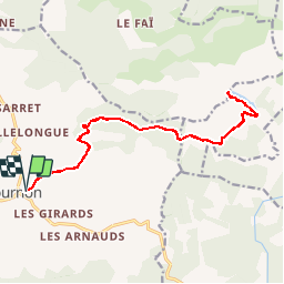

Length
18.4 km

Max alt
1586 m

Uphill gradient
1188 m
Km-Effort
34 km

Min alt
748 m

Downhill gradient
1188 m
Boucle
Yes
Creation date :
2019-05-28 09:24:27.904
Updated on :
2019-05-28 09:25:50.591
6h52
Difficulty : Very difficult

FREE GPS app for hiking
 SityTrail
IGN / Geographical institutes
SityTrail Plus
The world is yours!
About
Trail Walking of 18.4 km to be discovered at Provence-Alpes-Côte d'Azur, Hautes-Alpes, Savournon. This trail is proposed by claude nier.
Description
Longt tres longt ...a faire
Positioning
Country:
France
Region :
Provence-Alpes-Côte d'Azur
Department/Province :
Hautes-Alpes
Municipality :
Savournon
Location:
Unknown
Start:(Dec)
Start:(UTM)
722674 ; 4922563 (31T) N.
Comments