


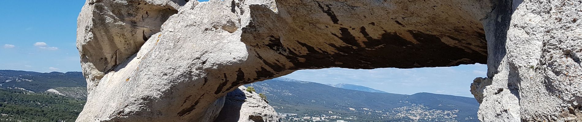
les crêtes de La Ciotat

amiral13
User GUIDE
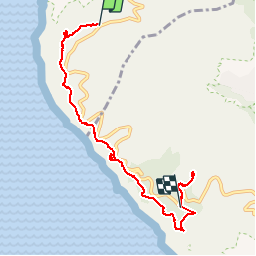

Length
7.4 km

Max alt
380 m

Uphill gradient
480 m
Km-Effort
13.8 km

Min alt
153 m

Downhill gradient
489 m
Boucle
No
Creation date :
2019-05-30 09:45:00.605
Updated on :
2019-06-10 16:03:25.345
3h49
Difficulty : Easy

FREE GPS app for hiking
 SityTrail
IGN / Geographical institutes
SityTrail Plus
The world is yours!
About
Trail Walking of 7.4 km to be discovered at Provence-Alpes-Côte d'Azur, Bouches-du-Rhône, Cassis. This trail is proposed by amiral13.
Photos


Positioning
Country:
France
Region :
Provence-Alpes-Côte d'Azur
Department/Province :
Bouches-du-Rhône
Municipality :
Cassis
Location:
Unknown
Start:(Dec)
Start:(UTM)
707865 ; 4786515 (31T) N.
Comments
Très belle vues du belvédère des calanques au sémaphore du bec de l'Aigle. L'une (la?) plus haute falaise de France.