Trail Walking Moult-Chicheboville - Mystère des disparus de Chicheboville - Photo

Mystère des disparus de Chicheboville

© OpenStreetMap contributors
Length
Length
5.5 km
Max alt
Max alt
31 m
Uphill gradient
Uphill gradient
31 m
Km-Effort
Km-Effort  
5.9 km
Min alt
Min alt
18 m
Downhill gradient
Downhill gradient
30 m
Boucle
Boucle
Yes
Creation date :
2019-05-30 15:49:26.993
Updated on :
2019-05-30 16:46:14.648

(0 Reviews)

Walking
Walking
1h18
Difficulty : Easy

Scan this QR Code to open this trail in the SityTrail application

FREE GPS app for hiking

Logo SityTrail SityTrail

IGN / Geographical institutes

Download SityTrail from the App Store Download SityTrail from Google Play

Logo SityTrail SityTrail World

The world is yours!

Download SityTrail from the App Store Download SityTrail from Google Play Download SityTrail on Huawei AppGallery

About

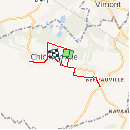
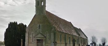
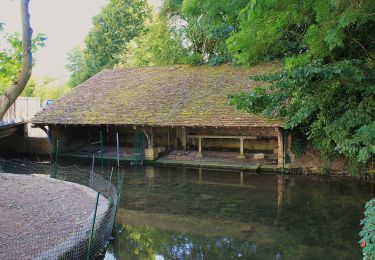
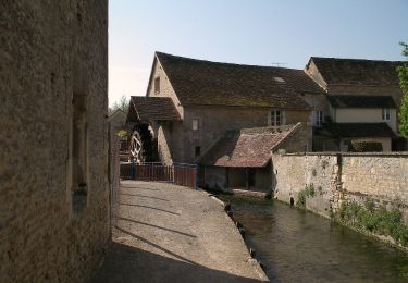
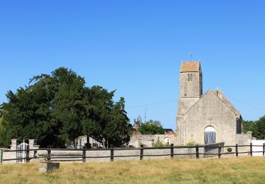
Trail Walking of 5.5 km to be discovered at Normandy, Calvados, Moult-Chicheboville. This trail is proposed by yannick-p.

Description

Petite balade sur les traces des disparus de Chicheboville à l'été 1944

Elevation profile

Photos

Points of interest

Point of interest Moult-Chicheboville - Église Saint-Martin de Chicheboville - Photo
yannick-p
MOULT-CHICHEBOVILLE 
Point of interest Moult-Chicheboville - Chapelle Notre-Dame de Béneauville - Photo
yannick-p
MOULT-CHICHEBOVILLE 

Positioning

Country:
France
Region :
Normandy
Department/Province :
Calvados
Municipality :
Moult-Chicheboville
Location:
Chicheboville
Start:(UTM)
703386 ; 5443268 (30U) N.

Trails nearby

Trail Nordic walking Moult-Chicheboville - 41b_les_eoliennes-6844076-1676016099-46 - Photo
Nordic walking
phi14

Nordic walking

Very easy
(1)
Moult-Chicheboville, Normandy, Calvados, France
8.6 km | 9.4 km-effort
Unknown
Yes
Trail Nordic walking Moult-Chicheboville - 2b_moult_bois_saint_gilles-11832667-1675352732-615 - Photo
Nordic walking
phi14

Nordic walking

Very easy
(1)
Moult-Chicheboville, Normandy, Calvados, France
8.7 km | 10 km-effort
Unknown
Yes
Trail On foot Argences - Les Crêtes d'Argences - Photo
On foot
PRO

On foot

Easy
Argences, Normandy, Calvados, France
6 km | 7.1 km-effort
1h 37min
Yes
Trail On foot Argences - Les Sentes de l'Avant Côte d'Auge - Photo
On foot
PRO

On foot

Easy
Argences, Normandy, Calvados, France
4.5 km | 5.3 km-effort
1h 12min
No
Trail On foot Argences - Vignes et Bruyères - Photo
On foot
PRO

On foot

Easy
Argences, Normandy, Calvados, France
15.9 km | 17.8 km-effort
4h 2min
Yes
Trail On foot Valambray - Bois, Vignes, Champs et Prés - Photo
On foot
PRO

On foot

Medium
Valambray, Normandy, Calvados, France
20 km | 23 km-effort
5h 15min
Yes
Trail On foot Valambray - La Tour de Valmeray et la Muance - Photo
On foot
PRO

On foot

Easy
Valambray, Normandy, Calvados, France
11.7 km | 12.7 km-effort
2h 53min
Yes
Trail On foot Valambray - Au Coeur des Parcs Eoliens - Photo
On foot
PRO

On foot

Easy
Valambray, Normandy, Calvados, France
12.5 km | 13.3 km-effort
3h 1min
Yes
Trail On foot Bellengreville - Le Marais des Terriers - Photo
On foot
PRO

On foot

Easy
Bellengreville, Normandy, Calvados, France
14.8 km | 16.2 km-effort
3h 40min
No


Close
My subscriptions