


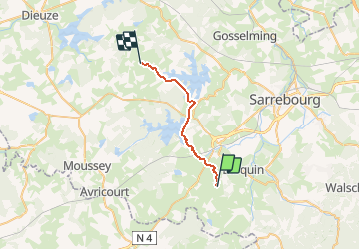
GR5_J18

michelelfn
User

Length
19.2 km

Max alt
325 m

Uphill gradient
174 m
Km-Effort
22 km

Min alt
242 m

Downhill gradient
248 m
Boucle
No
Creation date :
2014-12-10 00:00:00.0
Updated on :
2014-12-10 00:00:00.0
5h00
Difficulty : Easy

FREE GPS app for hiking
 SityTrail
IGN / Geographical institutes
SityTrail Plus
The world is yours!
About
Trail Walking of 19.2 km to be discovered at Grand Est, Moselle, Aspach. This trail is proposed by michelelfn.
Positioning
Country:
France
Region :
Grand Est
Department/Province :
Moselle
Municipality :
Aspach
Location:
Unknown
Start:(Dec)
Start:(UTM)
349961 ; 5391076 (32U) N.
Comments