


mont aurélien les batailloles

bernir
User
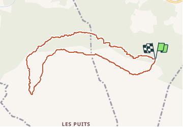

Length
10.4 km

Max alt
874 m

Uphill gradient
448 m
Km-Effort
16.4 km

Min alt
576 m

Downhill gradient
449 m
Boucle
Yes
Creation date :
2019-05-31 10:54:29.286
Updated on :
2020-01-04 16:32:36.92
5h01
Difficulty : Difficult

FREE GPS app for hiking
 SityTrail
IGN / Geographical institutes
SityTrail Plus
The world is yours!
About
Trail Walking of 10.4 km to be discovered at Provence-Alpes-Côte d'Azur, Var, Pourcieux. This trail is proposed by bernir.
Positioning
Country:
France
Region :
Provence-Alpes-Côte d'Azur
Department/Province :
Var
Municipality :
Pourcieux
Location:
Unknown
Start:(Dec)
Start:(UTM)
726503 ; 4814426 (31T) N.
Comments