


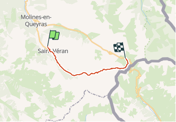
St Véran - refuge Agnel

motardes04
User

Length
13.1 km

Max alt
2880 m

Uphill gradient
958 m
Km-Effort
24 km

Min alt
1922 m

Downhill gradient
397 m
Boucle
No
Creation date :
2014-12-10 00:00:00.0
Updated on :
2014-12-10 00:00:00.0
4h40
Difficulty : Easy

FREE GPS app for hiking
 SityTrail
IGN / Geographical institutes
SityTrail Plus
The world is yours!
About
Trail Walking of 13.1 km to be discovered at Provence-Alpes-Côte d'Azur, Hautes-Alpes, Saint-Véran. This trail is proposed by motardes04.
Description
Etape 2 tour du Queyras GR58
Positioning
Country:
France
Region :
Provence-Alpes-Côte d'Azur
Department/Province :
Hautes-Alpes
Municipality :
Saint-Véran
Location:
Unknown
Start:(Dec)
Start:(UTM)
330621 ; 4952237 (32T) N.
Comments