


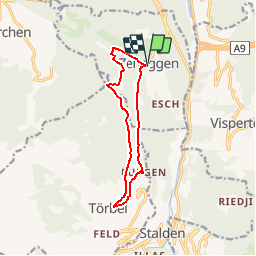


10.9 km | 20 km-effort


User


FREE GPS app for hiking
 SityTrail
IGN / Geographical institutes
SityTrail World
The world is yours!
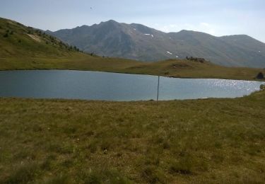
Trail Walking of 10.7 km to be discovered at Valais/Wallis, Visp, Zeneggen. This trail is proposed by duamerg.
A Zeneggen l'on trouve des places de parc non payantes. Suivre les panneaux jusqu'à Burgen puis grimper par le chemin vert jusqu'à Toerbel.
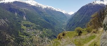
De magnifiques points de vues sur toute la vallée ainsi que sur le Weisshorn. Retour par le chemin du haut qui vous mène au hameau de Hostetti puis de Diepja.
La variante douce vous ramène à Zeneggen. Une variante raide est aussi proposée.
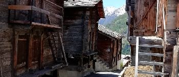
Promenade à faire au printemps quand les sommets sont encore enneigés. Pas difficulté particulière. De très beaux villages à visiter.


Other activity
Other activity

Walking
Other activity
Walking
Walking
Walking
Nordic walking
Walking