Trail Walking Forcé - tour forcé - Photo
© OpenStreetMap contributors
Length
Length
7.6 km
Max alt
Max alt
110 m
Uphill gradient
Uphill gradient
115 m
Km-Effort
Km-Effort  
9.1 km
Min alt
Min alt
47 m
Downhill gradient
Downhill gradient
115 m
Boucle
Boucle
Yes
Creation date :
2019-06-02 14:01:02.507
Updated on :
2019-06-02 15:45:13.819

(1 Reviews)

Walking
Walking
1h43
Difficulty : Very easy

Scan this QR Code to open this trail in the SityTrail application

FREE GPS app for hiking

Logo SityTrail SityTrail

IGN / Geographical institutes

Download SityTrail from the App Store Download SityTrail from Google Play

Logo SityTrail SityTrail World

The world is yours!

Download SityTrail from the App Store Download SityTrail from Google Play Download SityTrail on Huawei AppGallery

About

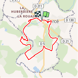
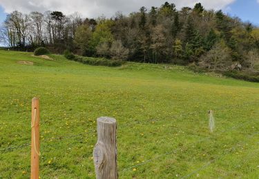
Trail Walking of 7.6 km to be discovered at Pays de la Loire, Mayenne, Forcé. This trail is proposed by Axelloceane.

Elevation profile

Photos

Positioning

Country:
France
Region :
Pays de la Loire
Department/Province :
Mayenne
Municipality :
Forcé
Location:
Unknown
Start:(UTM)
671100 ; 5322575 (30U) N.

Comments

Please log in to post a review or rate the element


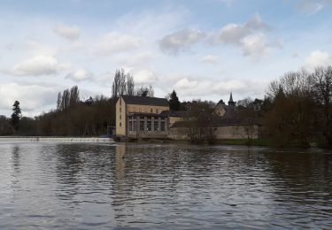
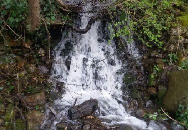
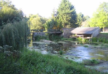
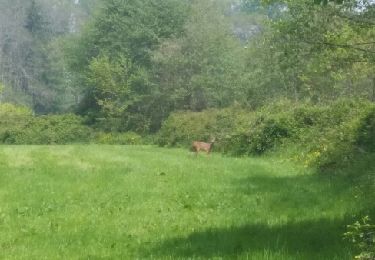
parfois mal indiqué mais très joli cadre


Trails nearby

Trail Walking L'Huisserie - L'Huisserie - Vicoin -La Mayenne - Photo
Walking
norbertdenise

Walking

Medium
(1)
L'Huisserie, Pays de la Loire, Mayenne, France
15.1 km | 18.8 km-effort
3h 3min
Yes
Trail Walking Forcé - Tour du pays de Laval (Forcé Soulgé sur Ouette) - Photo
Walking
Axelloceane

Walking

Easy
Forcé, Pays de la Loire, Mayenne, France
13.7 km | 15.3 km-effort
2h 45min
No
Trail Walking Parné-sur-Roc - Parné sur Roc - Photo
Walking
Axelloceane

Walking

Easy
Parné-sur-Roc, Pays de la Loire, Mayenne, France
11.6 km | 13.4 km-effort
2h 26min
Yes
Trail Walking Forcé - Forcé Entrammes - Photo
Walking
Axelloceane

Walking

Easy
Forcé, Pays de la Loire, Mayenne, France
15.3 km | 18.4 km-effort
3h 15min
Yes
Trail Mountain bike Argentré - La vallée de la Jouanne - Argentré - Photo
Mountain bike
tracegps

Mountain bike

Difficult
Argentré, Pays de la Loire, Mayenne, France
38 km | 47 km-effort
2h 30min
Yes
Trail Walking L'Huisserie - Autour de L'Huisserie vers Entammes - Photo
Walking
phimar_2612

Walking

Medium
L'Huisserie, Pays de la Loire, Mayenne, France
12.1 km | 14.9 km-effort
2h 52min
Yes
Trail Walking L'Huisserie - Tour de l'Huisserie - Photo
Walking
Axelloceane

Walking

Easy
L'Huisserie, Pays de la Loire, Mayenne, France
11 km | 13 km-effort
2h 10min
Yes
Trail Walking Forcé - forcé - Photo
Walking
rakapoute

Walking

Very easy
Forcé, Pays de la Loire, Mayenne, France
6.8 km | 8.1 km-effort
1h 32min
Yes
Trail Walking Parné-sur-Roc - Parné sur Roc - Photo
Walking
rakapoute

Walking

Easy
(1)
Parné-sur-Roc, Pays de la Loire, Mayenne, France
6.8 km | 7.8 km-effort
1h 31min
Yes


Close
My subscriptions