


Plan - rando du camp de Cesar

mireillemarmonier
User
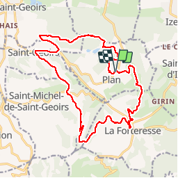

Length
21 km
Boucle
Yes
Creation date :
2019-06-02 06:49:36.0
Updated on :
2019-06-02 16:21:01.953
7h23
Difficulty : Difficult

FREE GPS app for hiking
 SityTrail
IGN / Geographical institutes
SityTrail Plus
The world is yours!
About
Trail Walking of 21 km to be discovered at Auvergne-Rhône-Alpes, Isère, Plan. This trail is proposed by mireillemarmonier.
Positioning
Country:
France
Region :
Auvergne-Rhône-Alpes
Department/Province :
Isère
Municipality :
Plan
Location:
Unknown
Start:(Dec)
Start:(UTM)
687683 ; 5020746 (31T) N.
Comments