![](/images/other/stat-length.png)
![Trail Walking Sparsbach - Boucle Sparsbach Englishberg - Photo](https://media.geolcdn.com/t/1900/400/ext.pjpeg?maxdim=2&url=https%3A%2F%2Fmedia.geolcdn.com%2Ff%2F4fb68a52-e3e0-457e-8f0f-c06538572aa8.jpg)
Boucle Sparsbach Englishberg
zazie
User
![Length](/images/other/stat-length.png)
Length
6 km
![Max alt](https://static1.geolcdn.com/siteimages/upload/files/1508320355ic_sort_altitude_max_24dp.png)
Max alt
382 m
![Uphill gradient](https://static1.geolcdn.com/siteimages/upload/files/1508320355ic_sort_den_pos_24dp.png)
Uphill gradient
180 m
![Km-Effort](/images/other/stat-length.png)
Km-Effort
8.4 km
![Min alt](https://static1.geolcdn.com/siteimages/upload/files/1508320355ic_sort_altitude_min_24dp.png)
Min alt
215 m
![Downhill gradient](https://static1.geolcdn.com/siteimages/upload/files/1508320355ic_sort_den_neg_24dp.png)
Downhill gradient
180 m
![Boucle](https://static1.geolcdn.com/siteimages/upload/files/16400158638029165_repeat_loop_refresh_sync_direction_icon.png)
Boucle
Yes
Creation date :
2019-06-02 15:07:12.159
Updated on :
2019-06-02 16:47:48.679
![Walking](https://static1.geolcdn.com/sitytour/trail-icons/101.png)
1h10
Difficulty : Easy
![Scan this QR Code to open this trail in the SityTrail application](https://capi.geolives.com/qq0zvz2zws4bq2lad0pu/sitytour/trails/2102660/qr.png?size=200)
FREE GPS app for hiking
About
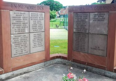
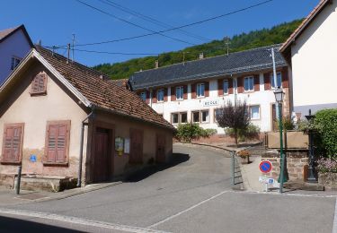
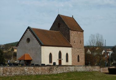
Trail Walking of 6 km to be discovered at Grand Est, Bas-Rhin, Sparsbach. This trail is proposed by zazie.
Description
Promenade sur les hauteurs de Sparsbach avec deux beaux points de vue sur les vallées. Geocatching à proximité d'un des bancs. Retour au Stade par chemin légèrement champêtre.
Positioning
Country:
France
Region :
Grand Est
Department/Province :
Bas-Rhin
Municipality :
Sparsbach
Location:
Unknown
Start:(Dec)
Start:(UTM)
383314 ; 5415207 (32U) N.
Comments
Trails nearby
![Trail On foot Wimmenau - Rectangle jaune barré de blanc - Photo](https://media.geolcdn.com/t/375/260/ext.jpg?maxdim=2&url=https%3A%2F%2Fmedia.geolcdn.com%2Ff%2F51150ed5-634a-4c59-9174-47e16c43d84d.jpeg)
![On foot On foot](https://static1.geolcdn.com/sitytour/trail-icons/100.png)
Rectangle jaune barré de blanc
On foot
Easy
Wimmenau,
Grand Est,
Bas-Rhin,
France
![](/images/other/stat-length.png)
4.7 km | 6.2 km-effort
1h 24min
![](https://static1.geolcdn.com/siteimages/upload/files/16400158638029165_repeat_loop_refresh_sync_direction_icon.png)
No
![Trail On foot Weiterswiller - Triangle bleu - Photo](https://media.geolcdn.com/t/375/260/ext.jpg?maxdim=2&url=https%3A%2F%2Fmedia.geolcdn.com%2Ff%2F7da8f487-201c-411e-a0e6-a462c915d4f0.jpeg)
![On foot On foot](https://static1.geolcdn.com/sitytour/trail-icons/100.png)
Triangle bleu
On foot
Easy
Weiterswiller,
Grand Est,
Bas-Rhin,
France
![](/images/other/stat-length.png)
11.6 km | 17.3 km-effort
3h 56min
![](https://static1.geolcdn.com/siteimages/upload/files/16400158638029165_repeat_loop_refresh_sync_direction_icon.png)
No
![Trail On foot Weiterswiller - Triangle jaune - Photo](https://media.geolcdn.com/t/375/260/ext.jpg?maxdim=2&url=https%3A%2F%2Fmedia.geolcdn.com%2Ff%2F2fc1dde7-68ae-4976-ba71-dd0452ef671a.jpeg)
![On foot On foot](https://static1.geolcdn.com/sitytour/trail-icons/100.png)
Triangle jaune
On foot
Easy
Weiterswiller,
Grand Est,
Bas-Rhin,
France
![](/images/other/stat-length.png)
14.6 km | 19.2 km-effort
4h 22min
![](https://static1.geolcdn.com/siteimages/upload/files/16400158638029165_repeat_loop_refresh_sync_direction_icon.png)
No
![Trail On foot Sparsbach - Chevalet rouge - Photo](https://media.geolcdn.com/t/375/260/ext.jpg?maxdim=2&url=https%3A%2F%2Fmedia.geolcdn.com%2Ff%2F3c8d475f-e614-4147-9cfd-8de0b9d1b061.jpeg)
![On foot On foot](https://static1.geolcdn.com/sitytour/trail-icons/100.png)
Chevalet rouge
On foot
Easy
Sparsbach,
Grand Est,
Bas-Rhin,
France
![](/images/other/stat-length.png)
3.2 km | 5.1 km-effort
1h 9min
![](https://static1.geolcdn.com/siteimages/upload/files/16400158638029165_repeat_loop_refresh_sync_direction_icon.png)
No
![Trail On foot Wingen-sur-Moder - Following in the footsteps of the Glass and Clog makers - Tour 1 - Photo](https://media.geolcdn.com/t/375/260/ext.jpg?maxdim=2&url=https%3A%2F%2Fmedia.geolcdn.com%2Ff%2F2701fee7-7fde-41ce-8533-df3afd35787c.jpeg)
![On foot On foot](https://static1.geolcdn.com/sitytour/trail-icons/100.png)
Following in the footsteps of the Glass and Clog makers - Tour 1
On foot
Medium
Wingen-sur-Moder,
Grand Est,
Bas-Rhin,
France
![](/images/other/stat-length.png)
17.4 km | 24 km-effort
5h 30min
![](https://static1.geolcdn.com/siteimages/upload/files/16400158638029165_repeat_loop_refresh_sync_direction_icon.png)
Yes
![Trail On foot La Petite-Pierre - Triangle rouge - Photo](https://media.geolcdn.com/t/375/260/ext.jpg?maxdim=2&url=https%3A%2F%2Fmedia.geolcdn.com%2Ff%2Fac14cb89-5ba1-4ba9-9b9a-6e7178a855f4.jpeg)
![On foot On foot](https://static1.geolcdn.com/sitytour/trail-icons/100.png)
Triangle rouge
On foot
Easy
La Petite-Pierre,
Grand Est,
Bas-Rhin,
France
![](/images/other/stat-length.png)
9.6 km | 13.1 km-effort
2h 59min
![](https://static1.geolcdn.com/siteimages/upload/files/16400158638029165_repeat_loop_refresh_sync_direction_icon.png)
No
![Trail On foot Erckartswiller - Croix jaune - Photo](https://media.geolcdn.com/t/375/260/ext.jpg?maxdim=2&url=https%3A%2F%2Fmedia.geolcdn.com%2Ff%2Fb607d783-b0bd-468f-b11d-0c0ef9fca815.jpeg)
![On foot On foot](https://static1.geolcdn.com/sitytour/trail-icons/100.png)
Croix jaune
On foot
Easy
Erckartswiller,
Grand Est,
Bas-Rhin,
France
![](/images/other/stat-length.png)
5.1 km | 6.7 km-effort
1h 31min
![](https://static1.geolcdn.com/siteimages/upload/files/16400158638029165_repeat_loop_refresh_sync_direction_icon.png)
No
![Trail On foot Zittersheim - Sentier des 12 Sources - Photo](https://media.geolcdn.com/t/375/260/ext.jpg?maxdim=2&url=https%3A%2F%2Fmedia.geolcdn.com%2Ff%2F7c683b9f-bff1-48af-8bf0-4d11df1457da.jpeg)
![On foot On foot](https://static1.geolcdn.com/sitytour/trail-icons/100.png)
Sentier des 12 Sources
On foot
Easy
Zittersheim,
Grand Est,
Bas-Rhin,
France
![](/images/other/stat-length.png)
6.4 km | 9.6 km-effort
2h 10min
![](https://static1.geolcdn.com/siteimages/upload/files/16400158638029165_repeat_loop_refresh_sync_direction_icon.png)
No
![Trail On foot Wimmenau - Green triangle - Photo](https://media.geolcdn.com/t/375/260/ext.jpg?maxdim=2&url=https%3A%2F%2Fmedia.geolcdn.com%2Ff%2Fcce851b6-feaa-4372-aef5-563fd7ab5810.jpeg)
![On foot On foot](https://static1.geolcdn.com/sitytour/trail-icons/100.png)
Green triangle
On foot
Easy
Wimmenau,
Grand Est,
Bas-Rhin,
France
![](/images/other/stat-length.png)
10.4 km | 15.6 km-effort
3h 33min
![](https://static1.geolcdn.com/siteimages/upload/files/16400158638029165_repeat_loop_refresh_sync_direction_icon.png)
No