


La Brosse

maxEA65
User

Length
10.8 km

Max alt
183 m

Uphill gradient
110 m
Km-Effort
12.3 km

Min alt
134 m

Downhill gradient
110 m
Boucle
Yes
Creation date :
2019-06-04 12:23:53.01
Updated on :
2019-06-04 14:16:46.225
1h52
Difficulty : Very easy

FREE GPS app for hiking
 SityTrail
IGN / Geographical institutes
SityTrail Plus
The world is yours!
About
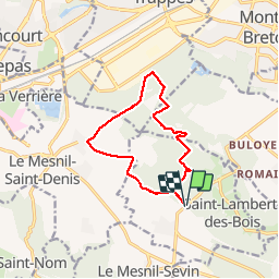
Trail Walking of 10.8 km to be discovered at Ile-de-France, Yvelines, Saint-Lambert. This trail is proposed by maxEA65.
Positioning
Country:
France
Region :
Ile-de-France
Department/Province :
Yvelines
Municipality :
Saint-Lambert
Location:
Unknown
Start:(Dec)
Start:(UTM)
426913 ; 5398211 (31U) N.
Comments