


courbes 34

jojomarette
User
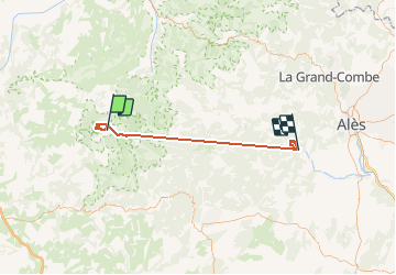

Length
60 km

Max alt
1311 m

Uphill gradient
4817 m
Km-Effort
127 km

Min alt
161 m

Downhill gradient
5725 m
Boucle
No
Creation date :
2019-06-05 07:11:07.757
Updated on :
2019-06-06 11:58:25.229
10h17
Difficulty : Very easy

FREE GPS app for hiking
 SityTrail
IGN / Geographical institutes
SityTrail Plus
The world is yours!
About
Trail Walking of 60 km to be discovered at Occitania, Gard, Saint-Sauveur-Camprieu. This trail is proposed by jojomarette.
Description
Bauf
Positioning
Country:
France
Region :
Occitania
Department/Province :
Gard
Municipality :
Saint-Sauveur-Camprieu
Location:
Unknown
Start:(Dec)
Start:(UTM)
538068 ; 4884638 (31T) N.
Comments