


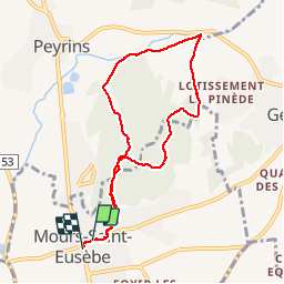
de Mours à Peyrins et retour

meillon
User

Length
8.4 km

Max alt
292 m

Uphill gradient
178 m
Km-Effort
10.7 km

Min alt
176 m

Downhill gradient
179 m
Boucle
Yes
Creation date :
2019-06-07 08:54:19.165
Updated on :
2019-06-07 12:02:23.43
3h05
Difficulty : Very easy

FREE GPS app for hiking
 SityTrail
IGN / Geographical institutes
SityTrail Plus
The world is yours!
About
Trail Walking of 8.4 km to be discovered at Auvergne-Rhône-Alpes, Drôme, Mours-Saint-Eusèbe. This trail is proposed by meillon.
Description
Drôme des collines
Positioning
Country:
France
Region :
Auvergne-Rhône-Alpes
Department/Province :
Drôme
Municipality :
Mours-Saint-Eusèbe
Location:
Unknown
Start:(Dec)
Start:(UTM)
661574 ; 4992873 (31T) N.
Comments