


20190607 Bus les Artois

Childebert
User
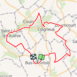

Length
19.4 km

Max alt
154 m

Uphill gradient
202 m
Km-Effort
22 km

Min alt
90 m

Downhill gradient
200 m
Boucle
Yes
Creation date :
2019-06-07 07:39:23.545
Updated on :
2019-06-07 19:25:45.477
6h10
Difficulty : Medium

FREE GPS app for hiking
 SityTrail
IGN / Geographical institutes
SityTrail Plus
The world is yours!
About
Trail Walking of 19.4 km to be discovered at Hauts-de-France, Somme, Bus-lès-Artois. This trail is proposed by Childebert.
Positioning
Country:
France
Region :
Hauts-de-France
Department/Province :
Somme
Municipality :
Bus-lès-Artois
Location:
Unknown
Start:(Dec)
Start:(UTM)
467244 ; 5550247 (31U) N.
Comments